From plot to export, traceability you can prove.
Sankora is the agricultural traceability and EU Deforestation Regulation (EUDR) compliance platform built by Kaada Group. Cooperatives, exporters and buyers share one register of farmers and plots: every polygon is checked, every plot analysed, every lot proven.
- EUDR-ready
- Polygons corrected automatically
- Built-in satellite analysis
- Lots 100% traced
until the EUDR applies to large and medium operators, on 30 December 2026. Micro and small enterprises: 30 June 2027.
Read our EUDR guideWhat used to take days of checking now happens before your eyes.
A faulty GPS survey, a plot on the edge of a forest, a file to hand to your buyer: watch Sankora handle them, just as it does for every one of your plots.
Every GPS survey is checked rule by rule. Common defects are fixed automatically; the others are explained.
- Closed polygonDefect foundClosed automatically
- GPS spikes1 outlier vertexSpike removed
- Self-intersectionNone
- Overlap with neighboursNone
- Farmer's GPS point inside polygonYes
- Computed area3.82 ha · consistent
Every plot is compared with satellite data, right inside Sankora. A lot at risk is flagged non-compliant before it is even shipped.
- 2020 tree cover
- Tree cover loss by year
- Recent deforestation alerts
- Your imported layers
Evidence kept · SHA-256 fingerprint 3f9a…c27e
Analyses, risks, geolocation and evidence come together in a file your customer can verify.
- PDFDue diligence report
- JSONStatement data
- GEOGeolocation of 214 plots
- CSVLinked plots and volumes
- PDFRisk assessment · negligible
- SHAFingerprint manifest
- Plots analysed214 / 214
- Volumes within capsYes
- Risk assessmentApproved · 4 eyes
- Geolocation formatEU-compliant
Illustrative animation · sample data · rules and sources actually applied by Sankora
Eight reasons to choose Sankora.
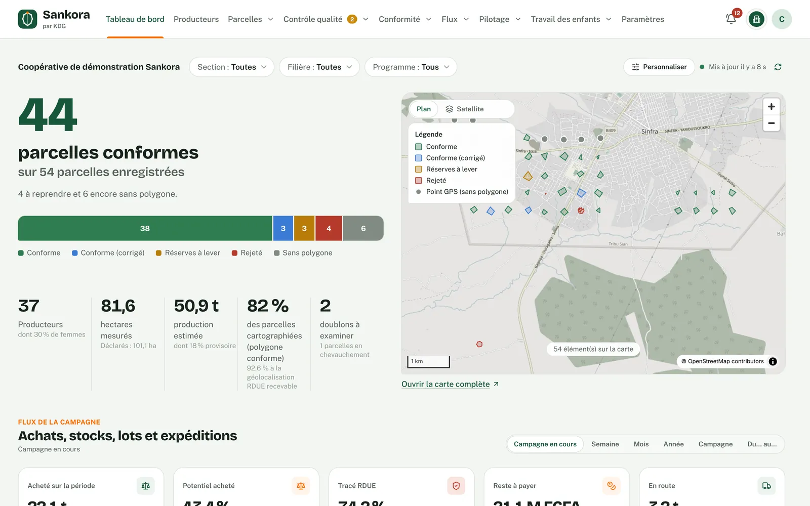
Each feature is shown with a real screen of the application.
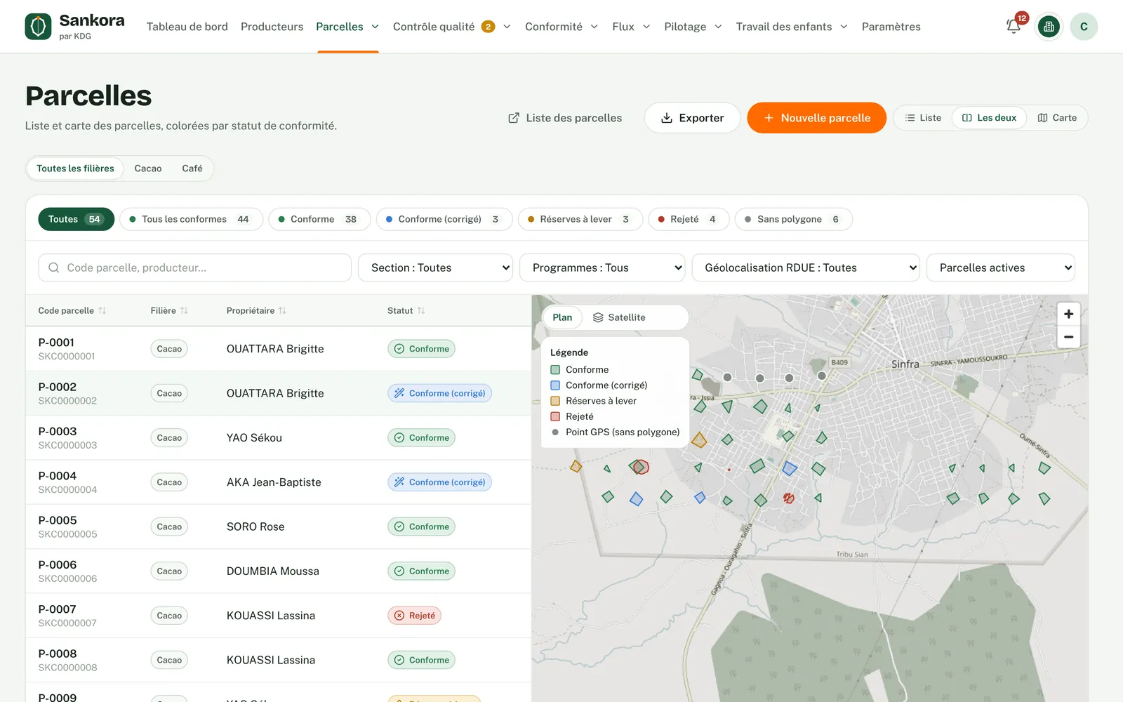
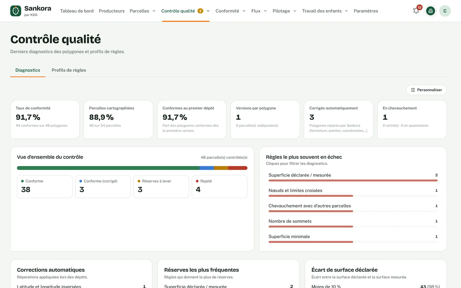
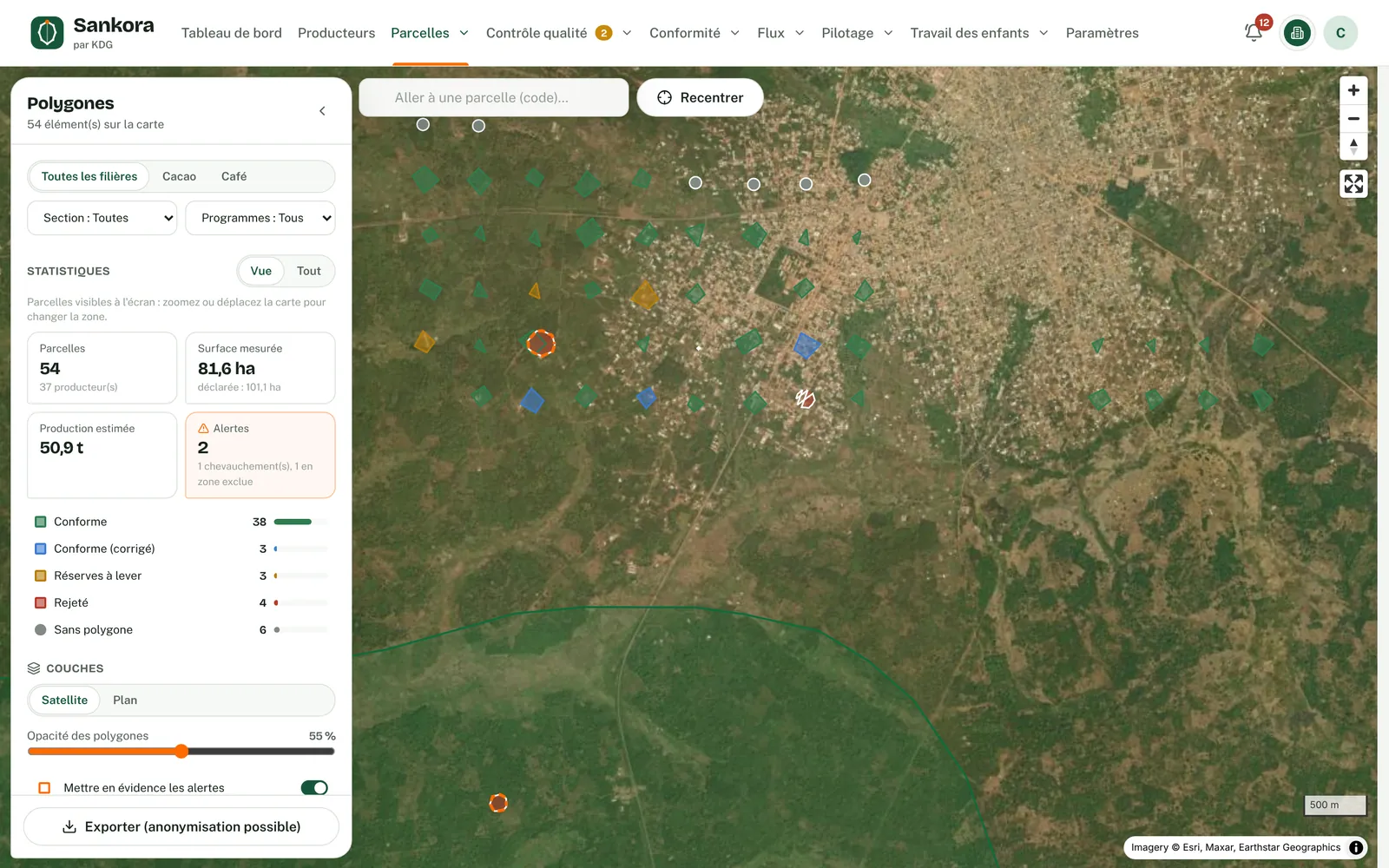
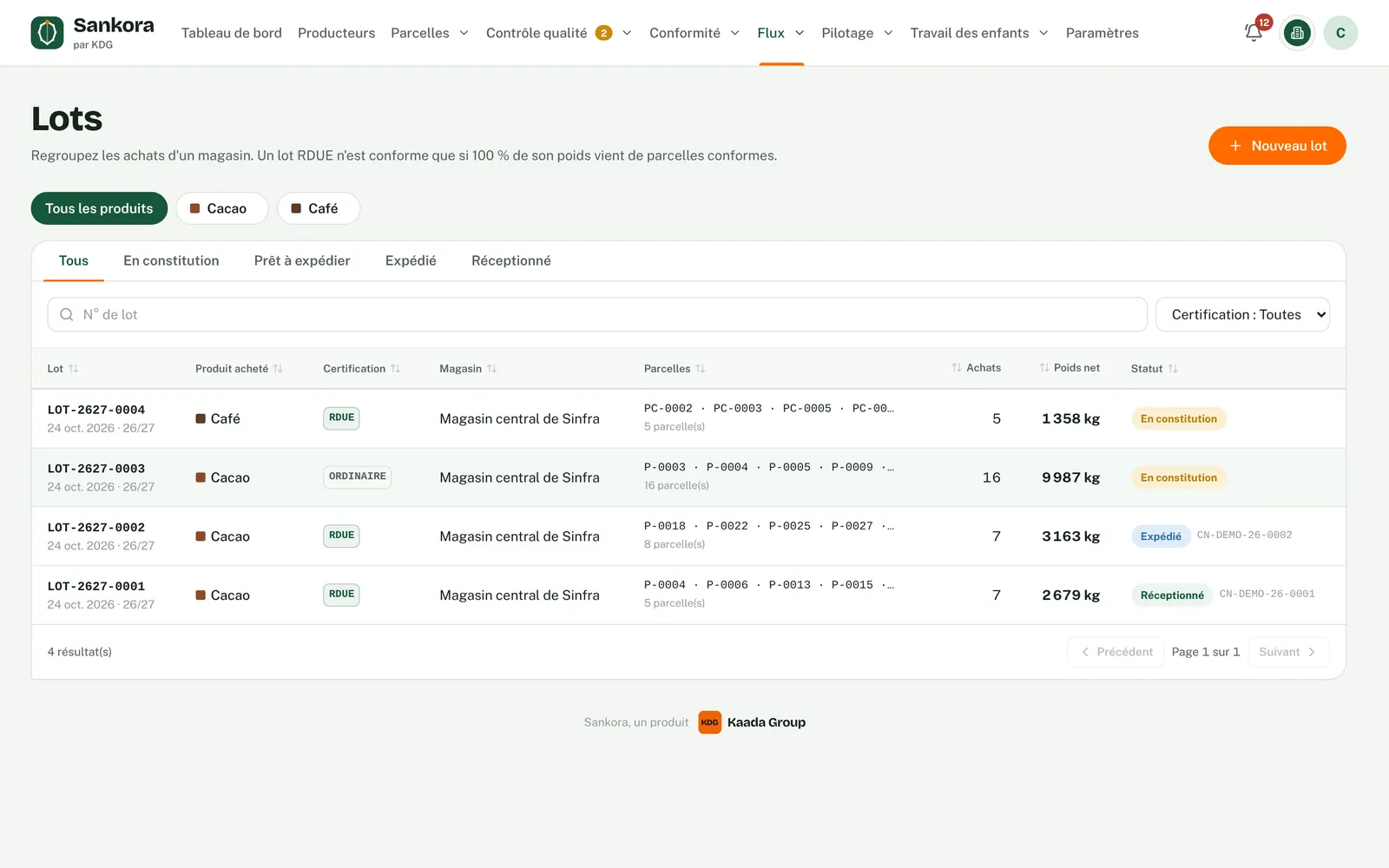
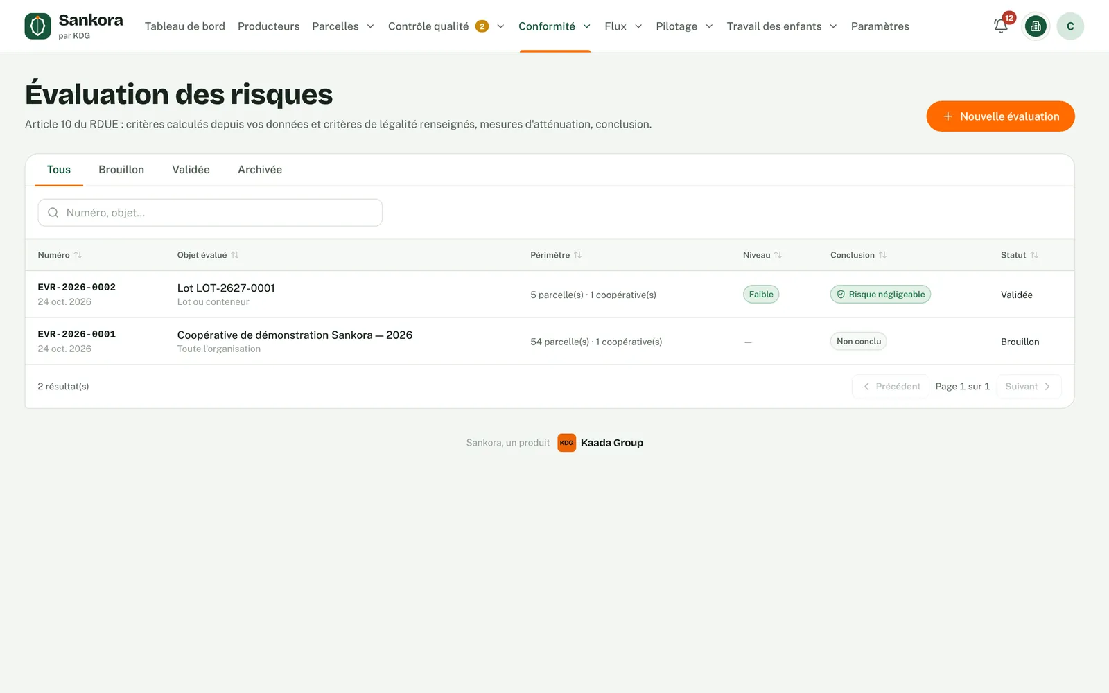
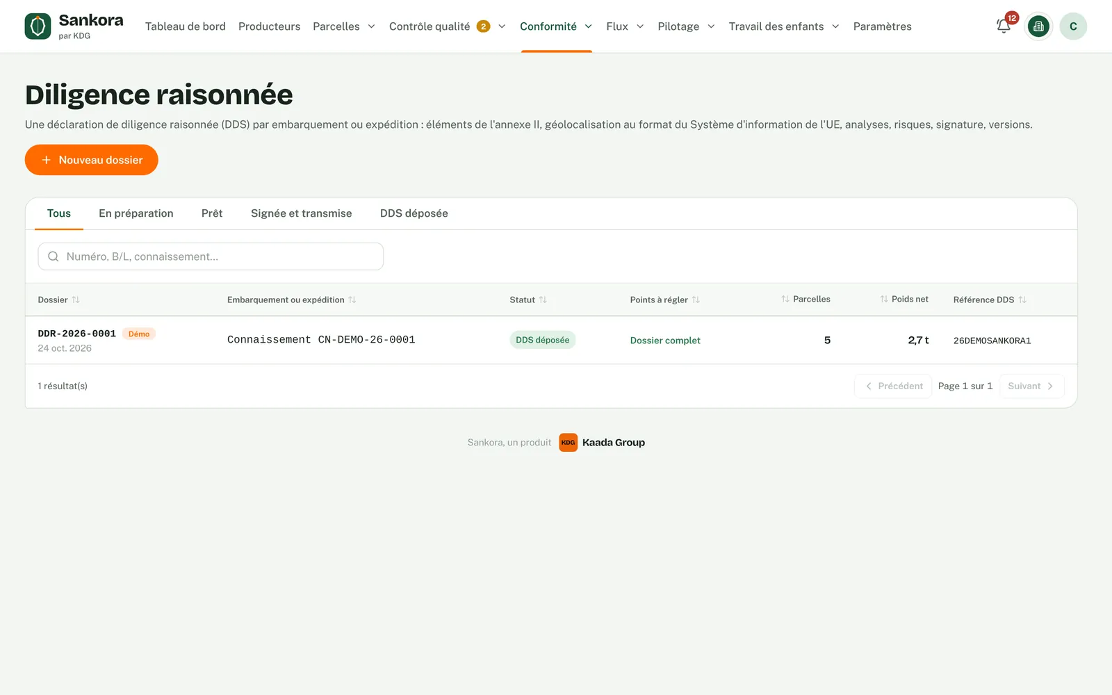
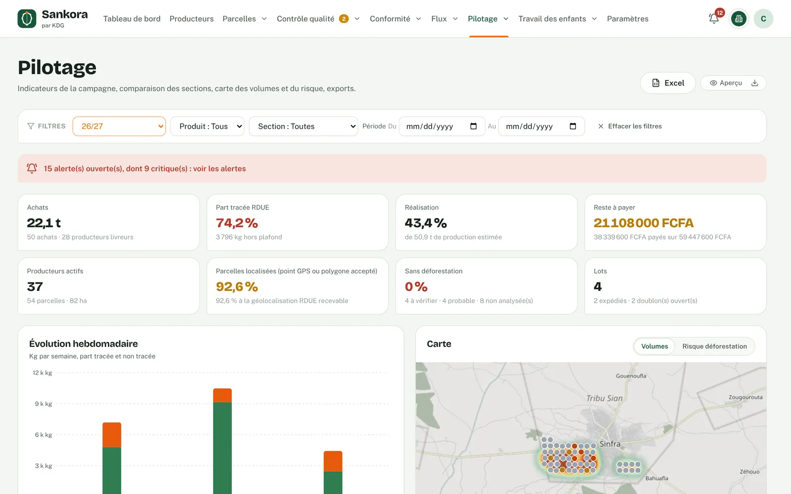
Real application screens · fictitious demo data · personal names hidden · map data © OpenStreetMap
From painstaking proof to instant proof.
The EUDR leaves no room for guesswork: a lot without proof is a lot that cannot be sold in Europe. Sankora turns every check into an automatic reflex.
Four layers, one source of truth.
Every module reads and enriches the same register of farmers and plots. Start with the core and add the modules you need, at your organisation's pace.
- 01RegisterFarmers, plots and polygons in one reference base, checked automatically.
- 02FlowsPurchases, payments, lots, shipments and receipts, linked to their plots of origin.
- 03EUDR complianceDeforestation analysis, risk assessment and due diligence file.
- 04MonitoringSeason indicators, automatic alerts and an assistant for your summaries.
A clean register, verified polygons.
Sankora takes your existing Excel files and GPS surveys, then checks every plot before accepting it. Common defects are corrected automatically; the others are explained, rule by rule, so they can be fixed at the source.
- Import of the Excel register and GeoJSON, KML or GPX polygons
- Reasoned diagnosis: unclosed polygon, GPS spike, overlap, swapped coordinates, inconsistent area
- Logged automatic corrections, with the original survey kept
- EUDR 4-hectare rule: a GPS point is enough up to 4 ha, a polygon is required above
Every kilo linked to its plot, from purchase to container.
From the farm-gate weighing ticket to receipt at the exporter, every movement is recorded and linked to its plots of origin, within their estimated production.
- Purchases with weighing ticket, tare per bag, moisture and season price
- Cap per plot: volumes above estimated production are flagged as over the cap
- Lots EUDR-compliant only when 100% traced, no mass balance
- Waybill read automatically, lot file sent to the exporter with its digital fingerprint
- Traced payments to farmers: cash, mobile money, transfer or cheque
Deforestation analysis, right inside the system.
Every plot is compared with the forest situation on 31 December 2020, using satellite data and your own layers. Results, assessments and decisions are kept as evidence and assembled into an exportable file.
- Automatic analysis using Global Forest Watch data: 2020 tree cover, annual losses, recent alerts
- A clear status per plot: deforestation-free, to review, probable deforestation
- Risk assessment and mitigation measures, in line with Articles 10 and 11 of the regulation
- File per shipment: statement data, geolocation in the format expected by the EU, PDF report
- Four-eyes rule: the person who drafts is never the one who approves
See the season in real time, get alerted before problems arise.
Key season indicators fit on one screen. Every night, Sankora looks for anomalies and flags them before a buyer or auditor finds them.
- Traced share, progress against estimated production, amounts left to pay, lots ready and in transit
- Alerts: deliveries beyond what is possible, abnormal yields, split purchases, weighing gaps, late payments
- Heat map of volumes and deforestation risk, Excel and PDF export
- Built-in assistant to query your data in plain language; it reads aggregates only, never farmers' personal data
Data4Child completes Sankora.
The Data4Child module follows every identified child, from the household survey to their lasting exit from work, with an offline Android app.
Every link in the chain benefits.
When both the cooperative and the exporter use Sankora, lots and receipts flow from one account to the other, with no re-keying or file exchange.
Cooperatives
Keep a reliable register, buy by the rules, pay farmers transparently and send lots the exporter accepts without argument.
- Checked register and polygons
- Purchases, stock, lots and shipments
- Traced receipts and payments
- Direct link with your exporters
Exporters
Receive verifiable lot files, build 100% traced containers and produce the due diligence file for every shipment.
- Arrivals, weighing and quality analyses
- Containers and sales contracts
- Risk assessments and EUDR files
- Consolidated view of all your cooperatives
Buyers and end customers
Access proof of origin for the lots you buy, without relying on file exchanges or unverifiable statements.
- Dedicated customer space
- Lots, plots of origin and analyses
- Statements sent by your suppliers
- Deforestation analyses on hand
Built for sensitive data.
Farmer registers, geolocation, compliance evidence: Sankora applies strict access rules and keeps a record of every action.
Your data stays yours
Each organisation sees only its own data. The Kaada Group team runs the platform without access to its customers' registers.
Tamper-proof evidence
Analyses, lot files and decisions carry a digital fingerprint: the slightest change is detected.
Traceable decisions
Lifting a flag, approving an assessment, cancelling a purchase: every decision records its author, its reason and its supporting document.
Precise roles
Administrator, quality manager, observer: everyone sees only what their role allows, and the four-eyes rule protects approvals.
Up and running for your season.
End-to-end support, from the demo to follow-up after go-live.
- 01
Demo
45 minutes on sample data, tailored to your commodity and your role in the chain.
- 02
Proposal
Choice of modules and number of farmers, quote then contract.
- 03
Go-live
Import of your existing register, polygon checks and season set-up.
- 04
Training
Hands-on sessions for your office teams and field agents.
- 05
Support
Support from Abidjan, regular updates and regulatory monitoring.
What we are asked most often.
Our polygons come from several providers: is that a problem?
Can we bring in our existing data?
How does Sankora analyse deforestation risk?
Does Sankora file the due diligence statement?
Which commodities are covered?
How is Sankora priced?
See Sankora on your own cases.
Fill in this form: we will get back to you within one business day to schedule a 45-minute demo, online or in Abidjan.
- Free and with no commitment
- Tailored to your commodity and your role
- Reply within one business day
See Sankora on your own cases.
A 45-minute demo, tailored to your commodity and your place in the chain. Free and with no commitment.