Deadlines are close
Regulation (EU) 2023/1115 applies from 30 December 2026 to large and medium-sized companies, and from 30 June 2027 to micro and small enterprises. Your European buyers are already asking for proof.
EUDR compliance
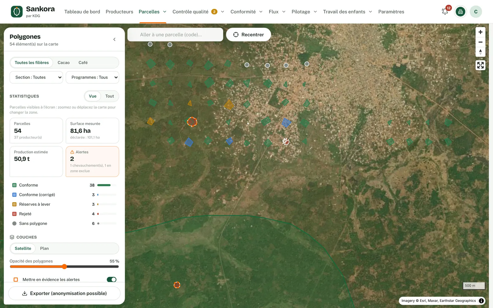
Each plot is compared with forest cover on 31 December 2020, using satellite data and your own layers. The results feed an Article 10 risk assessment, approved by a second person.
Regulation (EU) 2023/1115 applies from 30 December 2026 to large and medium-sized companies, and from 30 June 2027 to micro and small enterprises. Your European buyers are already asking for proof.
A product can only enter the EU market if its plots were not deforested after 31 December 2020. A single doubtful plot can make a whole lot unsellable in Europe.
A plot that encroaches on a classified forest or protected area also raises a legality issue. You need to catch it before purchase, not after loading.
An analysis commissioned once from a third party covers neither new plots nor recent alerts. Evidence must be kept up to date and on file.
The polygon in force, or failing that the GPS point with a 50-metre buffer, is compared with 2020 forest cover, year-by-year tree cover loss and recent alerts. Global Forest Watch data and your own layers are combined, and the least favourable source prevails.
Each plot gets a status: deforestation-free, to be checked, likely deforestation or analysis not possible. The analysis is stored with its sources, their versions and a SHA-256 fingerprint.
A satellite result is a signal, not a verdict. An authorised person clears or confirms each flag, with a reason, a type of evidence and a document.
For a lot, container, shipment, contract or supplier, Sankora computes the measurable criteria: geolocation, polygons, deforestation, protected areas, mixing, duplicates. You fill in the legality criteria and mitigation measures.
Whoever drafted or contributed to the assessment cannot approve it. A "negligible" conclusion is only possible if all residual levels are low, and the list of assessed plots is then frozen.
An EUDR lot containing a plot with likely deforestation is not compliant. An assessment only covers a shipment if all its plots are within its scope.
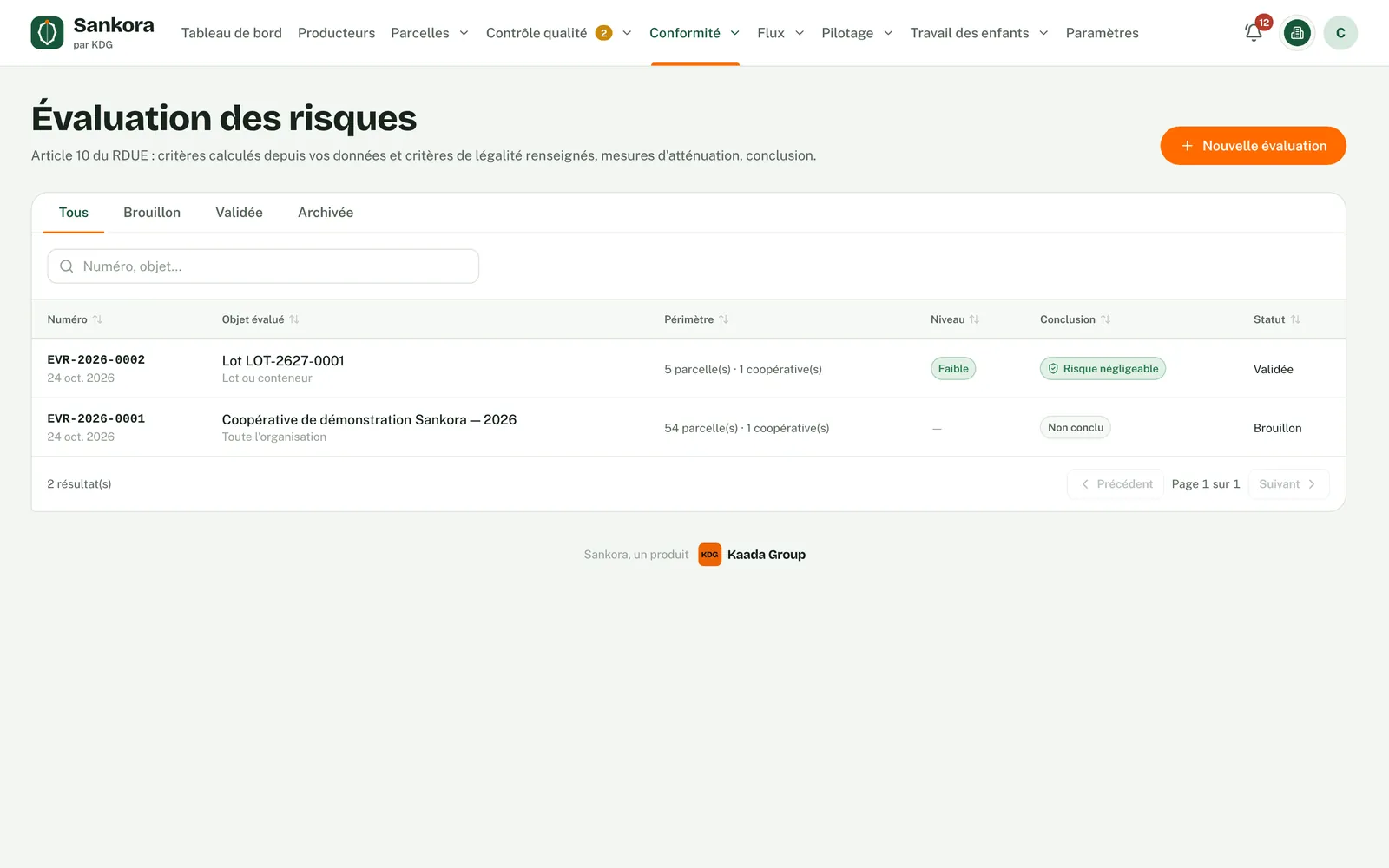
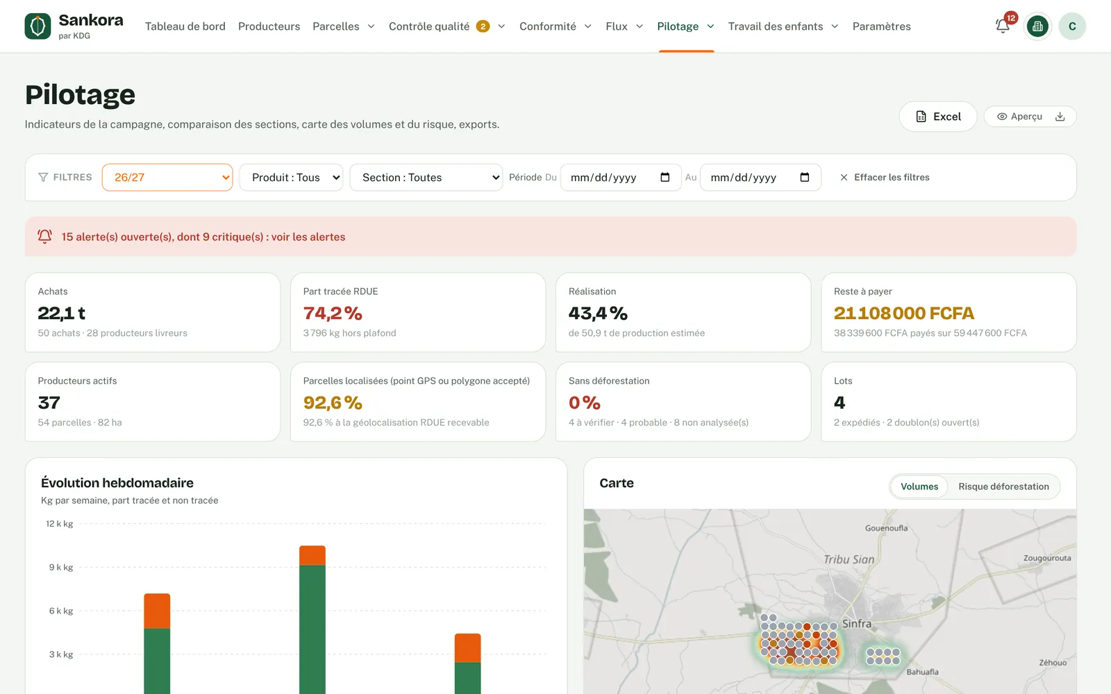
Real application screenshots · fictitious demo data
Spot at-risk plots before purchase and pass their analysis status on to your exporters in lot files.
Reuse your cooperatives' analyses or analyse the plots of origin yourself, then assess each container or shipment.
Receive shipments assessed with a documented method, with analyses and decisions available to review.
Analysed plots, assessed risks and logged decisions, ready to show your buyer or an inspector.
No. It is a reasoned signal that guides verification: the reference forest map sometimes classifies agroforestry cocoa as forest. That is why an authorised person clears or confirms each flag, with evidence.
Yes, if it is 4 hectares or less: its GPS point is analysed with a 50-metre buffer. Above 4 hectares, the regulation requires a polygon.
No. In Sankora, a certification does not equal EUDR compliance. It is taken into account as complementary information in the risk assessment.
Your organisation, following a logged method. Sankora computes what it can, requires a second person to approve, and refuses a "negligible" conclusion while any residual level remains medium or high.